I can see Guksabong Peak (국사봉) from our window!
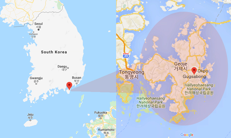
Living in Geoje Island in South Korea, this is one of my favorite hiking trails ever! It’s just right next to my apartment and it’s not difficult hiking at all!
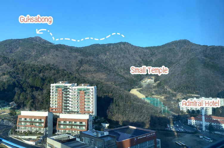
Guksabong view from our window.
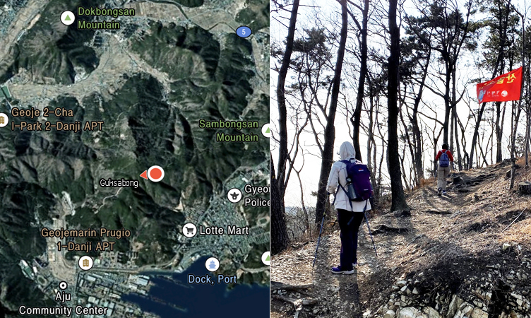
Guksabong is a 464m or 1522 feet high peak between the Okpo and Aju-dong area. My way to Guksabong starts from Lotte Mart, behind the Amiral Hotel in Okpo.
There are so many trails to do the Gugsabong peak (국사봉정상), as you can see there are connected mountain trails from Okpo to Aju-dong.
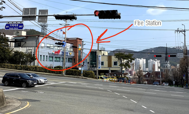
We started from Lotte Mart (Okpo) and walked behind the Admiral Hotel and back around to the Okpo Main Road (Opposite The Fire Station 소방서).
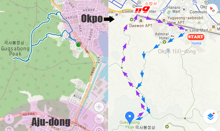
It’s not recommended on a rainy day or the day after rain due to the steep slope. Our round trip today is 6.7km, you need to bring water and some snacks with you, and hiking sticks would be helpful for this trip.
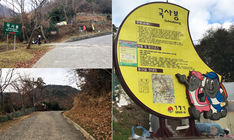
When we first moved to Geoje Island, I just walked around this area. I saw the sign for Guksabong but I didn’t know much more than what I can read that sign!
Then I saw some people walked up and down behind the temple. Then I took Stacey and Elizabeth for the 2nd try but no one knew how far we could walk and we gave up…
I went back there by myself for the and went just a little more than before, I saw many people kept walking down and passing me. I was not feeling comfortable to go up there by myself because I didn’t see those people when I started and why they’re so many people walking down???
Finally, Marta just moved back to Okpo, she used to live here and hike all around here before. So she knows how to hike up there!
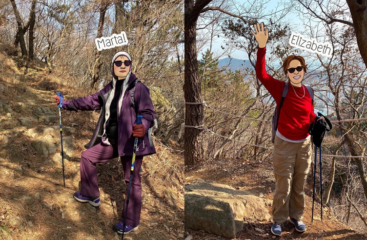
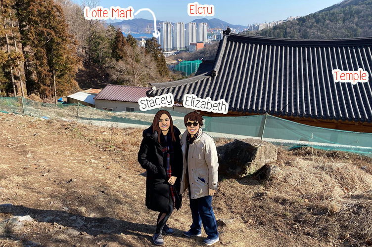
Marta, Elizabeth and I started on the RIGHT trail to Guksabong!
As I mentioned, we started the trail behind the Admiral Hotel, just walking up the road you will see this temple. Or you can just drive to park your car up here!
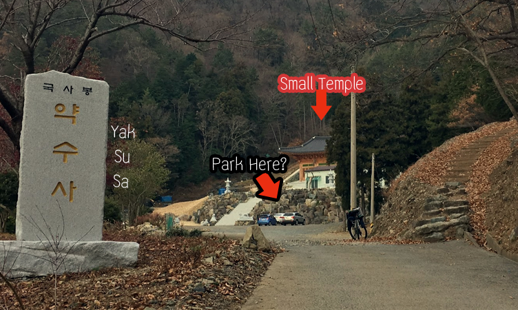
Go behind the temple and you will see the trail.
They don’t do many signs here, so keep walking up until you think you are on top of the mountain!
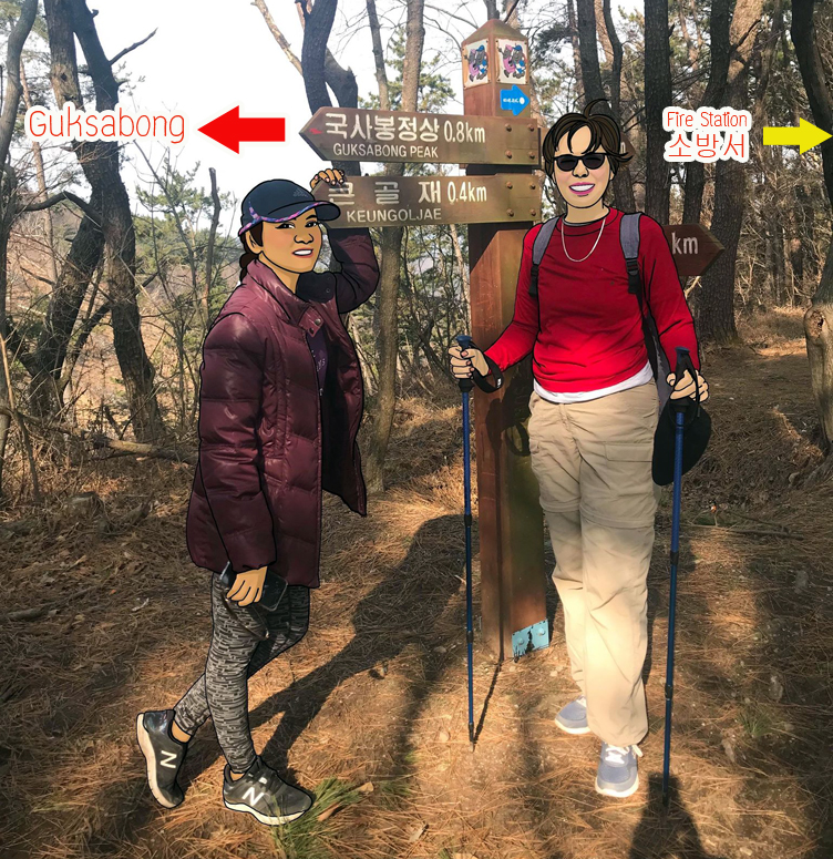
Here you will see the sign “Guksabong 0.8km”, keep following the sign for Guksabong which is showing in Korean as 국사봉.
Just remember that we will come back to this spot on the way back, and follow the sign for Fire Station 소방서 (Yellow arrow).
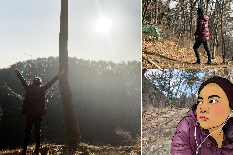
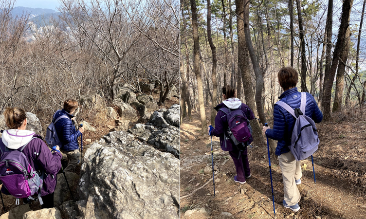
Guksabong Peak is even just 0.8km but we are crossing one mountain to others!
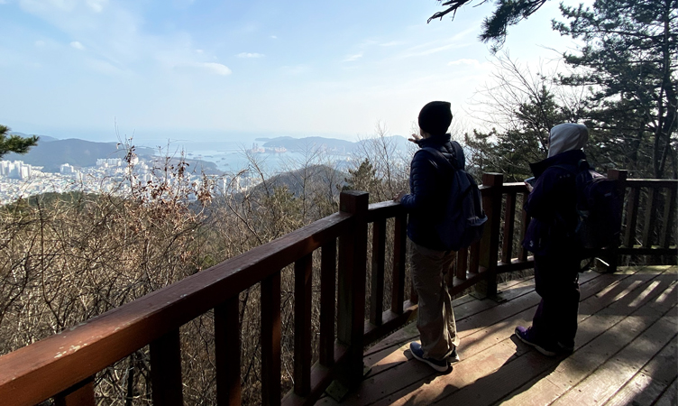
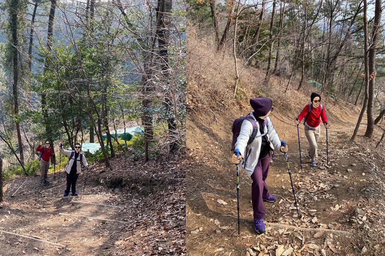
Halfway, there is another viewpoint for a good birds-eye view of Okpo city!
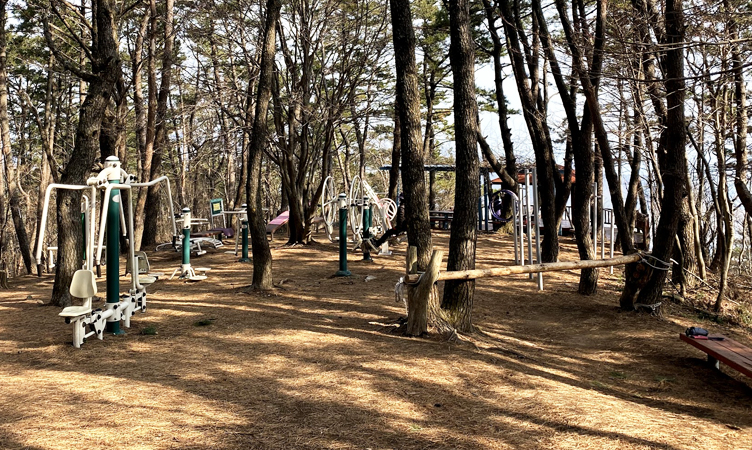
This is my favorite spot for resting ever!
Nice view and it looks like a nice outdoor gym if hiking is not enough for your workout!
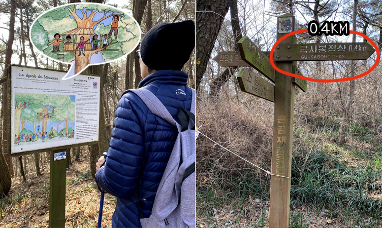
We are not yet at Guksabong, the sign says about 400meters more.
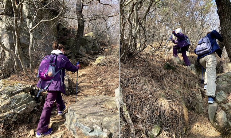
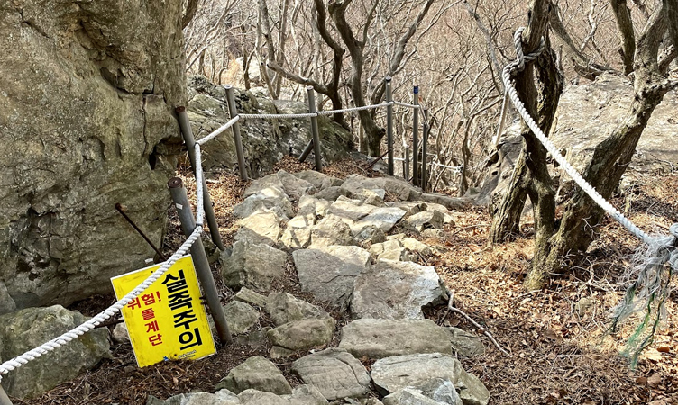
From here to Guksabong is harder, rocky and needs a little climbing skill.
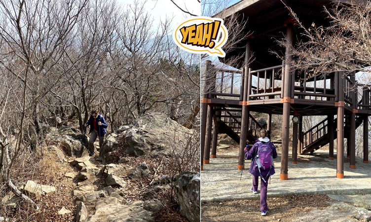
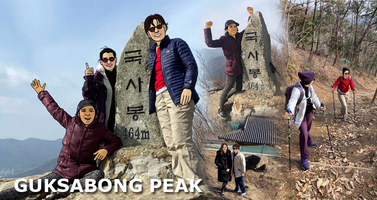
And if you see the hectagon house, that means you are there “GUKSABONG”!!!
Just be careful to find the way up to the rock sign for Gugsabong.
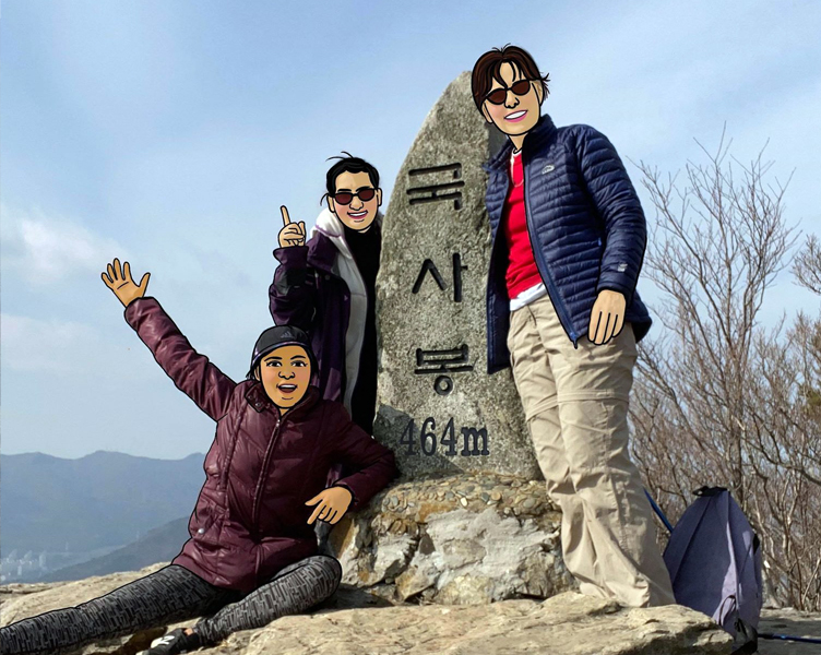
And yes we made it to the 464meter peak!!!
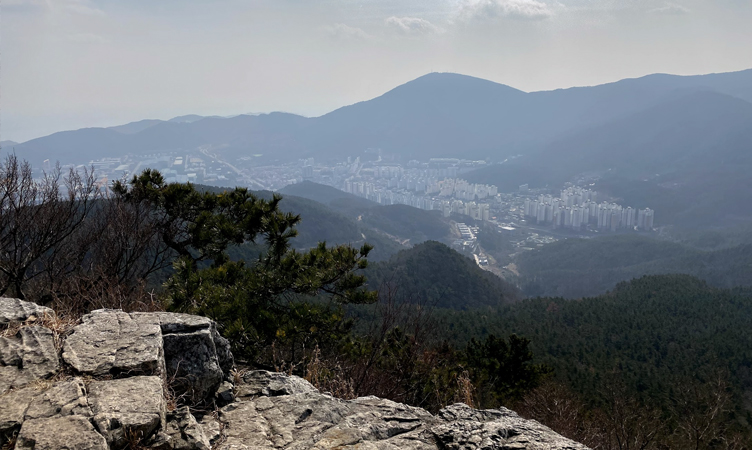
I think I can see the whole city of Okpo and Aju-Dong from here, what a view!!!
There is another way down (very steep) to the Aju dong Apartment (I would like to try sometime!)
But we walked back to the way we came until the first mountain, then we follow the sign for Fire Station.
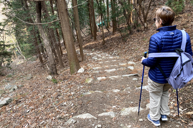
This is a long walkway back but it’s nice, flat and easy to walk.
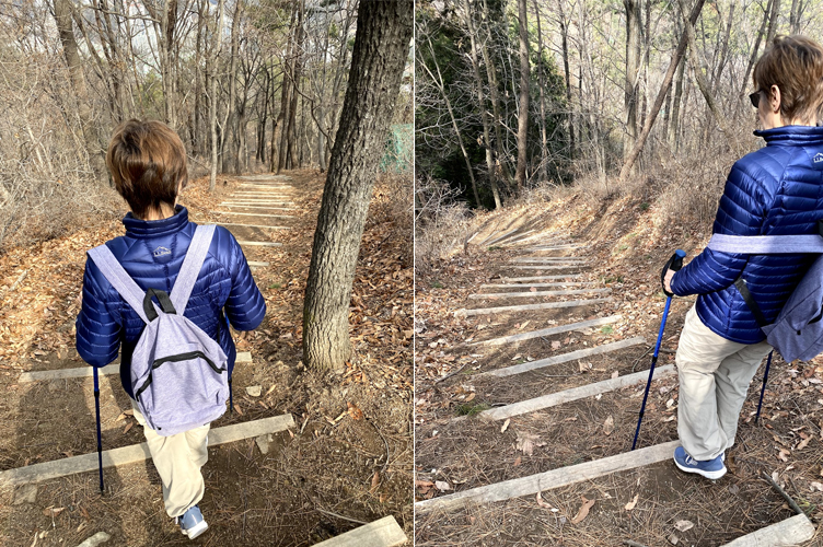
It’s only one way to walk, it’s hard to get lost.
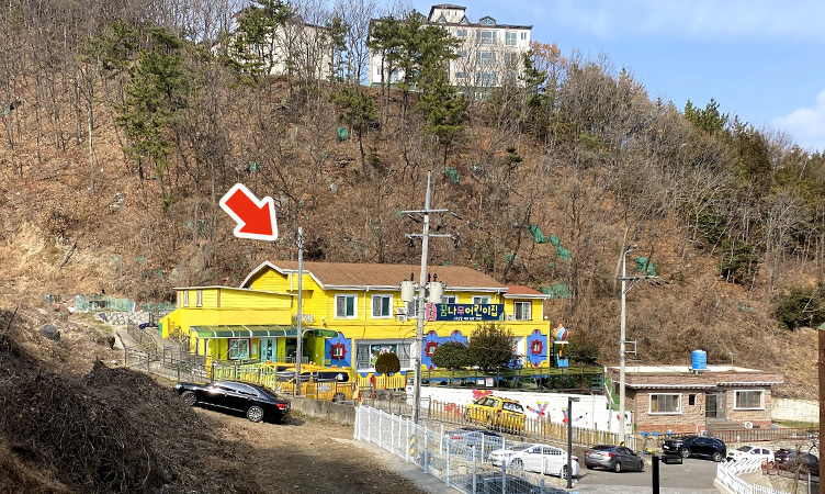
Walk until you can see the yellow house (looks like a kindergarten or nursery school).
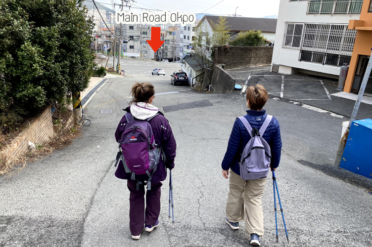
Then head to the main road Okpo until you see the Fire Station on the opposite side of the road and we turn right and head back to the Lotte Mart (Elcru Apartments) where we live!
That’s our hike today in early February, the weather is about 3-10c, we can do Guksabong hiking as much as we want because we live right next to it 🙂